Everything you need to assess a site
Explore for free. Upgrade when you need the full picture.
Updated daily from 365 official council registers. 5,493 new DAs added this week.
Free
Explore the map, browse leads, and run basic feasibility drafts.
- Browse the first 60 DA leads per search (partial address)
- Interactive map with zoning and overlays
- Feasibility calculator (basic)
- Save drafts to My Projects
- Basic business directory listing
Pro
Less than the cost of one site visit.
The full site assessment toolkit. Property scores, AI analysis, and complete lead data.
- Everything in Free, plus:
- 8 Property Scores per address NEW
- Noise, Flood, Bushfire, Solar, Heat Island, Walkability, Contamination, View Quality
- AI feasibility analysis + PDF export
- Risk assessment, sensitivity modelling, project comparison
- Full address, council DA document links, CSV export
- Unlimited AI chat queries
- Featured profile with logo + priority placement
- Weekly DA digest emails for your trade
Cancel anytime. No lock-in contracts.
For developers & data teams
DA List API
The raw DA feed behind this site: AI-classified applications from 365 councils with 18 structured fields, geocoded and updated daily. Starter and Scale are licensed for internal team analysis; customer-facing embedding, onward access and redistribution require Enterprise.
See what Pro unlocks
Real screenshots from the platform. This is what $49/month gets you.
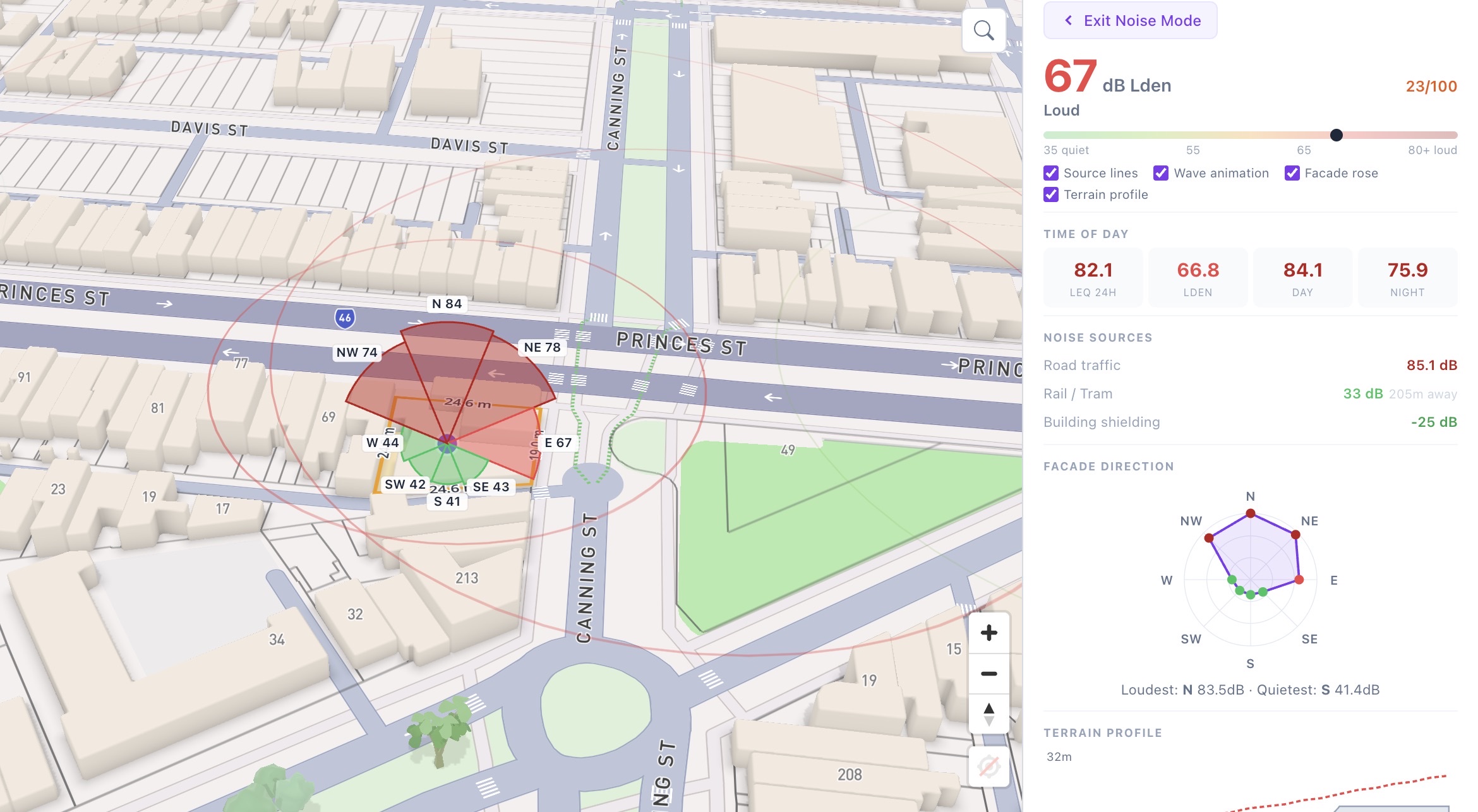
8 Property Scores
Noise, flood, bushfire, solar, heat island, walkability, contamination, and view quality per address.
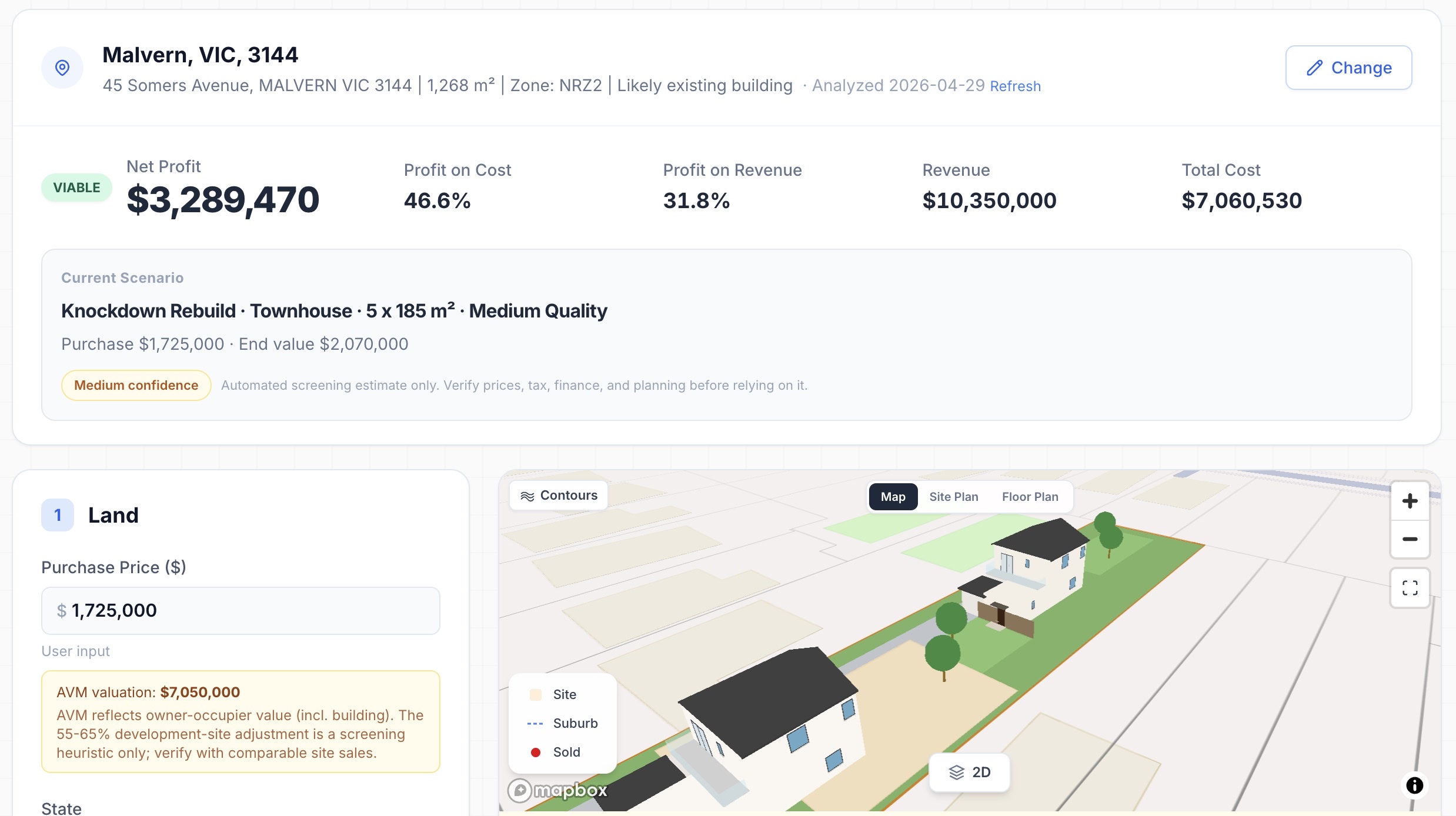
AI Feasibility Analysis
Risk assessment, sensitivity modelling, and side-by-side project comparison with PDF export.
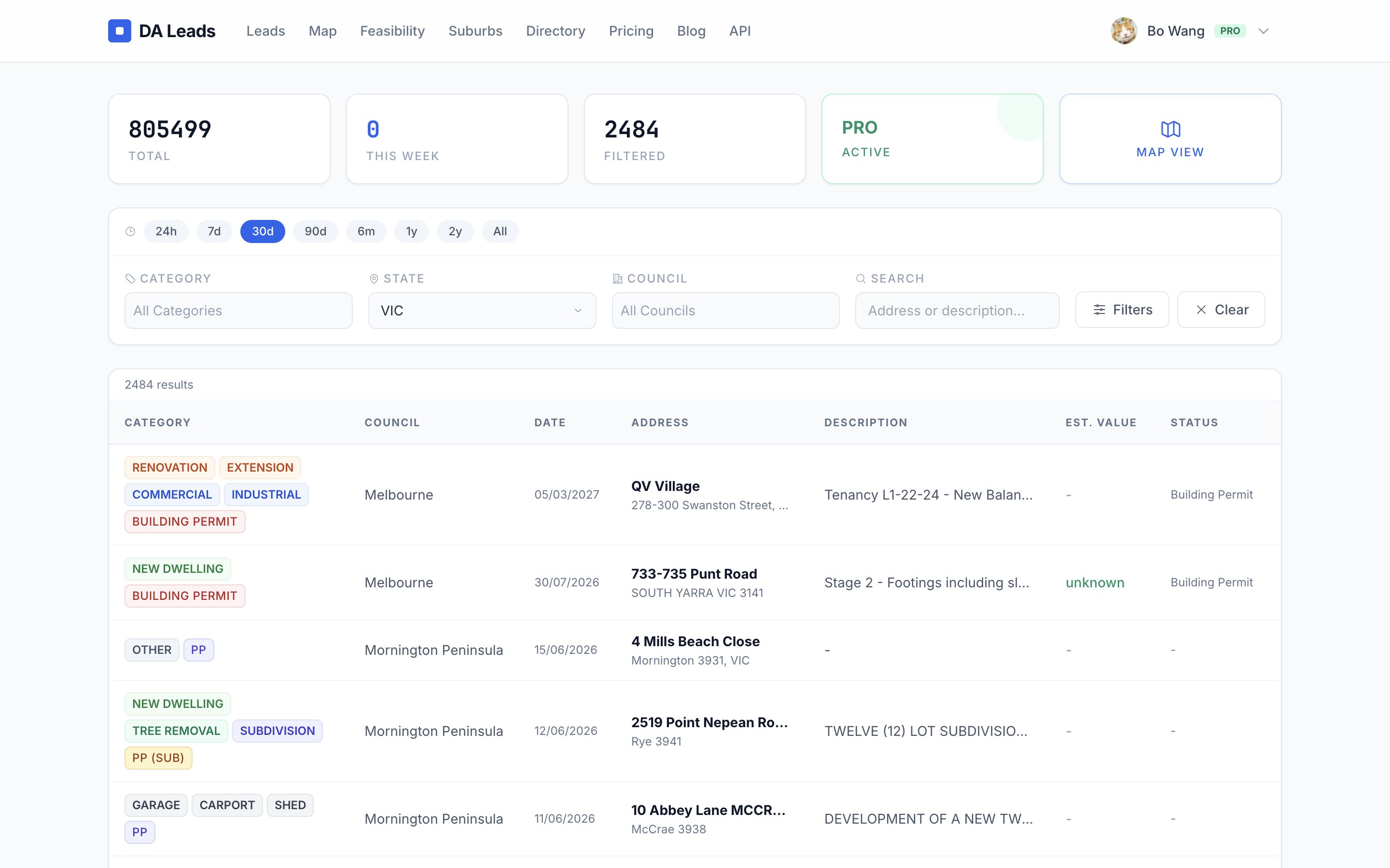
Complete Lead Data
Full site address on every lead, plus direct links to official DA documents and plans where the council publishes them. Free only shows partial addresses.
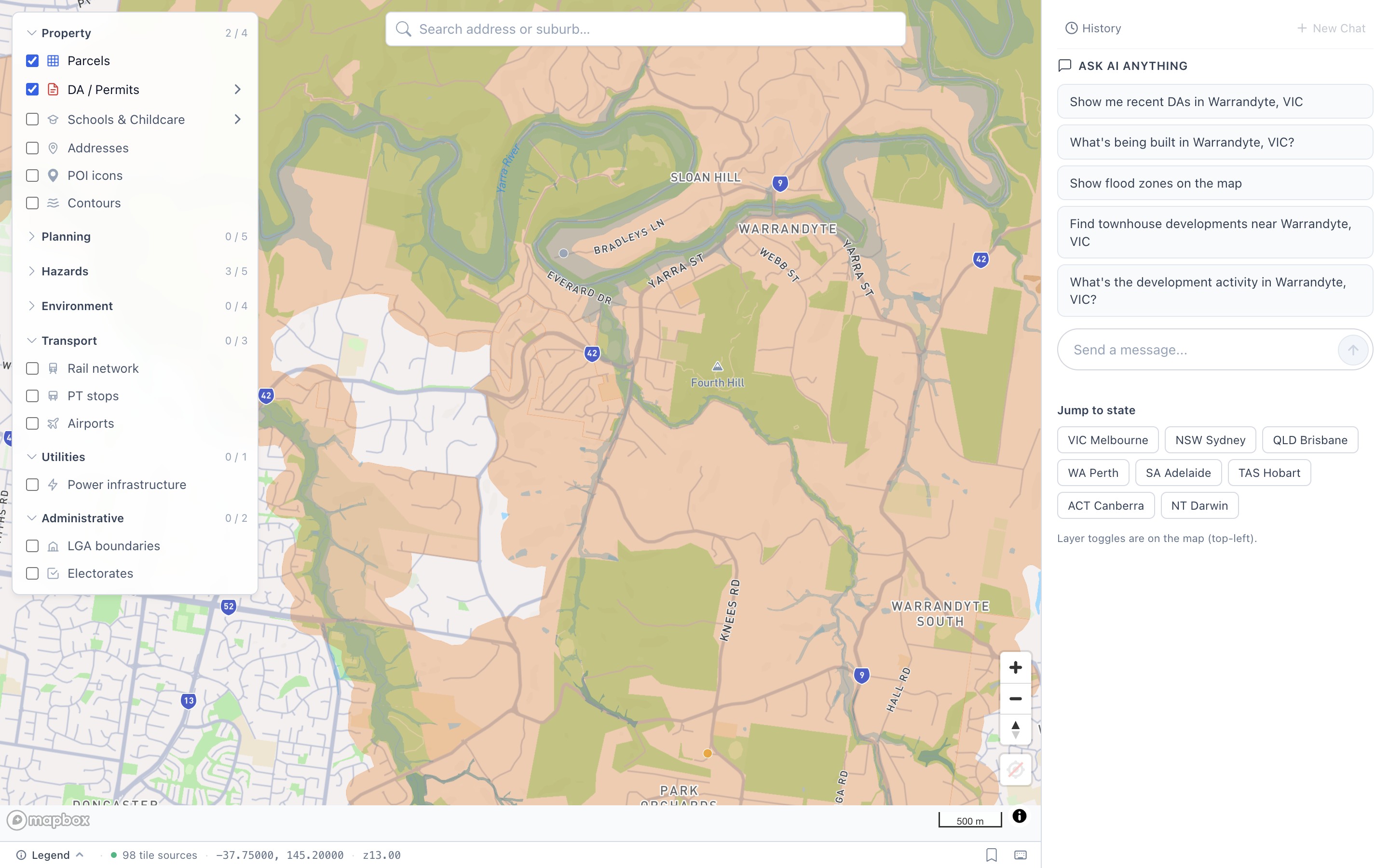
130+ Map Layers
Bushfire, flood, contamination overlays, school catchments, zoning, parcels, contours, and more.
Free vs Pro: Feature by Feature
See exactly what you get at each tier.
| Feature | Free | Pro |
|---|---|---|
| Map & Data | ||
| Interactive map with 130+ layers | ||
| DA leads browsing + filtering | ||
| Full site address on each lead | - | |
| Council DA document links (where published) | - | |
| Google Maps link on lead detail | - | |
| CSV export of saved leads | - | |
| Property Scores | ||
| Noise Score (headline number) | ||
| 8 detailed scores (facade, terrain, source breakdown) | - | |
| AI Chat | ||
| Property AI chat (ask anything about a site) | ||
| Daily query limit | - | |
| Unlimited AI chat queries | - | |
| Feasibility | ||
| Basic calculator (purchase, value, costs) | ||
| Address research (zoning, sold listings, nearby DAs) | ||
| Save drafts to My Projects | ||
| AI analysis (risks, market context, recommendation) | - | |
| Sensitivity analysis (price and cost scenarios) | - | |
| Project comparison (townhouse, duplex, apartment) | - | |
| Save project templates | - | |
| PDF report export | - | |
| Business Profile | ||
| Basic directory listing | ||
| Company logo upload | - | |
| Custom trade categories (up to 5) | - | |
| Featured badge + priority placement | - | |
| Weekly DA digest emails for your trade | - | |
Built on real data, not estimates
We collect development applications daily from 365 council registers across Australia.
Property Scores
Every Australian address gets 8 scores. Flood adds official 1% AEP modelled depth where an integrated council study covers the point, with source and coverage status stated explicitly. See a real result.
Free
The headline score for all 8 dimensions, for any address in Australia, on the map and the score pages.
Pro — $49/mo
The full breakdown behind every score: facade directions, terrain profiles, official overlays, fuel and temperature data, plus ESI reports with scores included.
Bulk & API
Per-address JSON for platforms, portfolios and research, including flood depth or H1-H6 where published and honest no-study coverage states. Inspect the sample.
Common Questions
What are Property Scores?
What does the AI analysis include?
Where does the data come from?
Can I cancel anytime?
Is there a free trial?
For teams & platforms
Need the data itself?
Everything this site knows, licensed for research teams, buyers agencies and proptech platforms: development applications from 365 councils updated daily, planning, hazard and environment layers, and all 8 modelled property scores with the underlying data behind each number, delivered per address through a simple API.
Start with the map. Upgrade when you're ready.
No credit card required for free tier. Pro is $49/month, cancel anytime.