Solutions // Warehouse & Logistics Site Screening

Planning red flags for warehouse and logistics sites.

A planning and environment screening memo for warehouse and logistics candidates anywhere in Australia. 19 constraints checked against public spatial data: zoning, easements crossing the parcel, ecology triggers, heritage, flood and bushfire, with the operational freight task treated as intrinsic rather than incidental. The filter you run before spending real money on consultants, not a substitute for them.

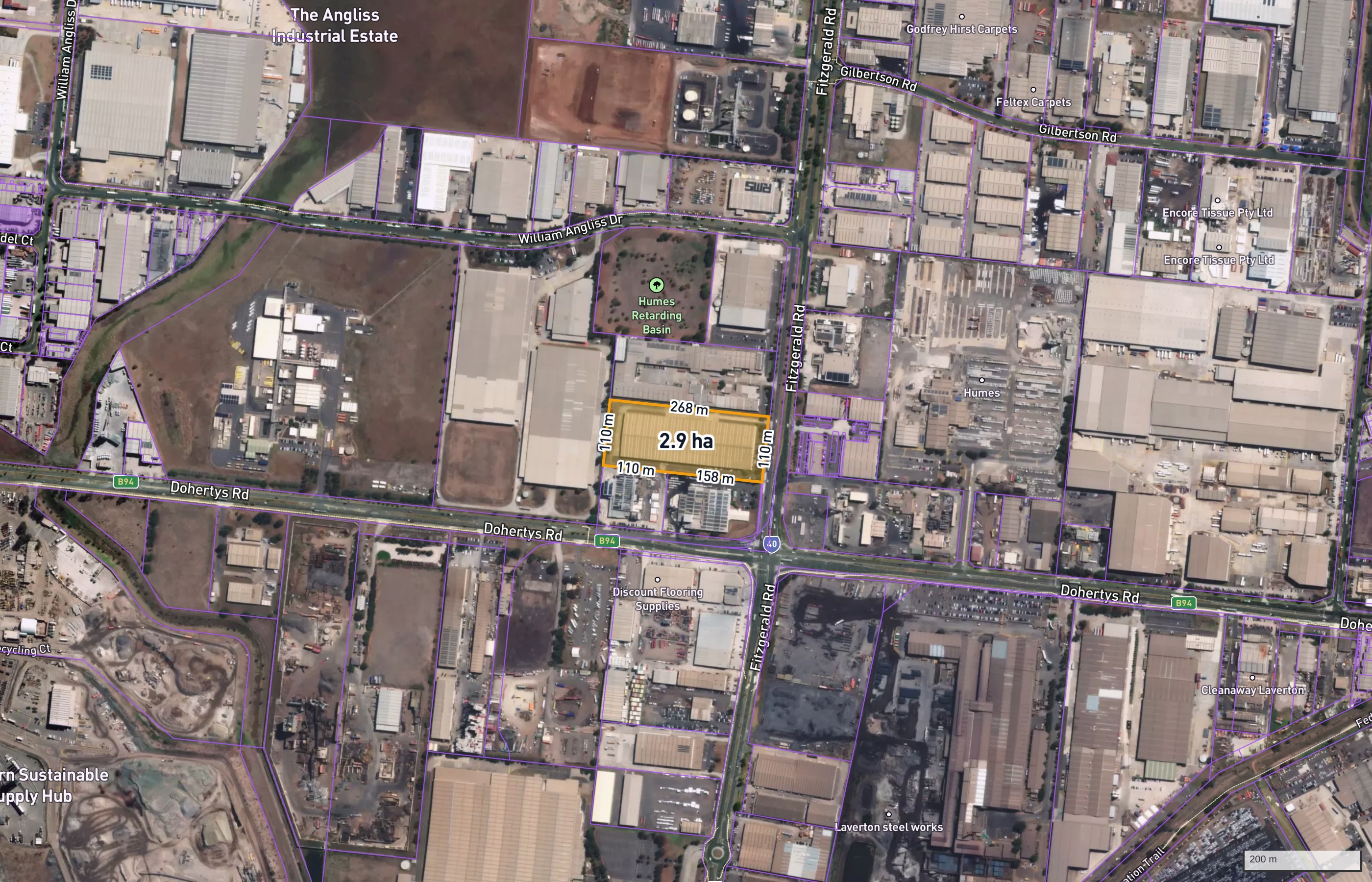
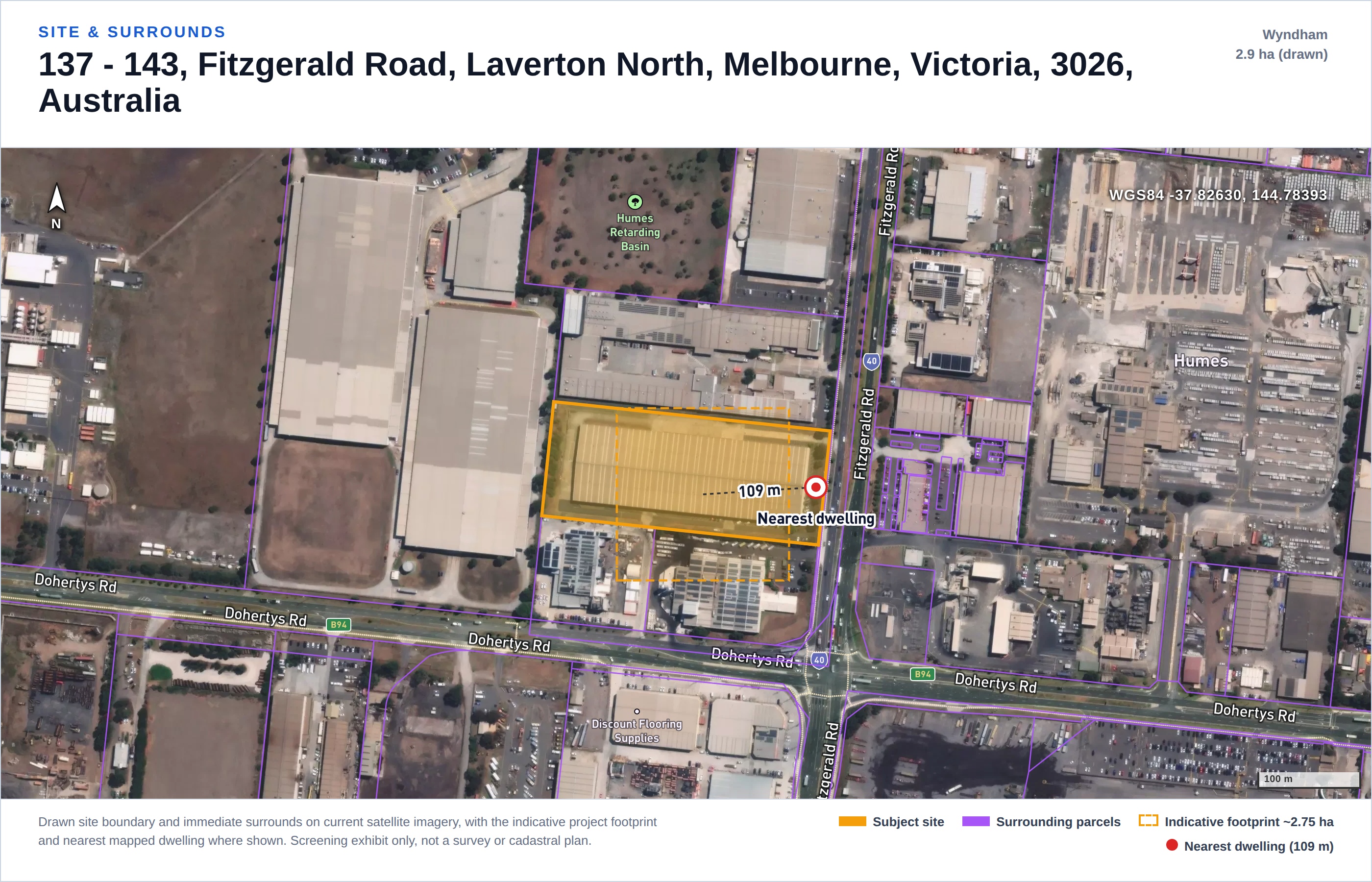
Sample screening report: site and surrounds satellite figure, Laverton North VIC industrial infill parcel
Sample verdict
No fatal flaws identified
5 moderate · risk score 50/100 · data 100%
Re
Planning & Environment Red Flags Assessment
Project
Laverton North Warehouse Screening (demo) · Warehouse / Logistics
Site
137 - 143, Fitzgerald Road, Laverton North, Melbourne, Victoria, 3026, Australia · 2.9 ha
Council / State
Wyndham · VIC

The Evidence

One real sample. Every line below is from it.

This is the actual constraint table of the sample report: a 2.9 ha industrial-zoned infill lot in Laverton North, in Melbourne's west, the scale a single-facility warehouse actually gets built on. Each row carries its own rating and a separate data status, and in the full report each becomes a section with statutory references and sources. The screen found what really shapes logistics siting in this corridor: an easement crossing the lot, volcanic-plain grassland ecology nearby, the operational freight task rated as a primary assessment matter, and a nearest address point the report flags as possibly non-residential rather than quietly calling it a dwelling.

Zoning insignificant assessed · clean
Cadastral / Title & Easements moderate assessed · hit
Planning Overlays insignificant assessed · clean
Aboriginal Heritage minor assessed · hit
Historic / Federal Heritage insignificant assessed · clean
Bushfire insignificant assessed · clean
Flora & Fauna / Ecology moderate assessed · hit
EPBC / Matters of National Significance moderate assessed · hit
Hydrology / Flooding insignificant assessed · clean
Noise (residential amenity) moderate assessed · hit
Visual Amenity minor assessed · hit
Contours / Topography insignificant assessed · clean
Geotechnical minor data limited
Soils insignificant assessed · clean
Utilities (power / gas / water / NBN) insignificant assessed · hit
Traffic & Access moderate data limited
Contaminated Land insignificant assessed · clean
Air Quality minor assessed · hit
Hazard & Risk (fire / explosion) minor assessed · hit
major — potential fatal flaw moderate — needs mitigation minor — readily mitigated insignificant pending — data unavailable, disclosed as such
Site and surrounds satellite exhibit with indicative footprint
Site & surrounds exhibit
Constraint context map exhibit
Constraint context exhibit
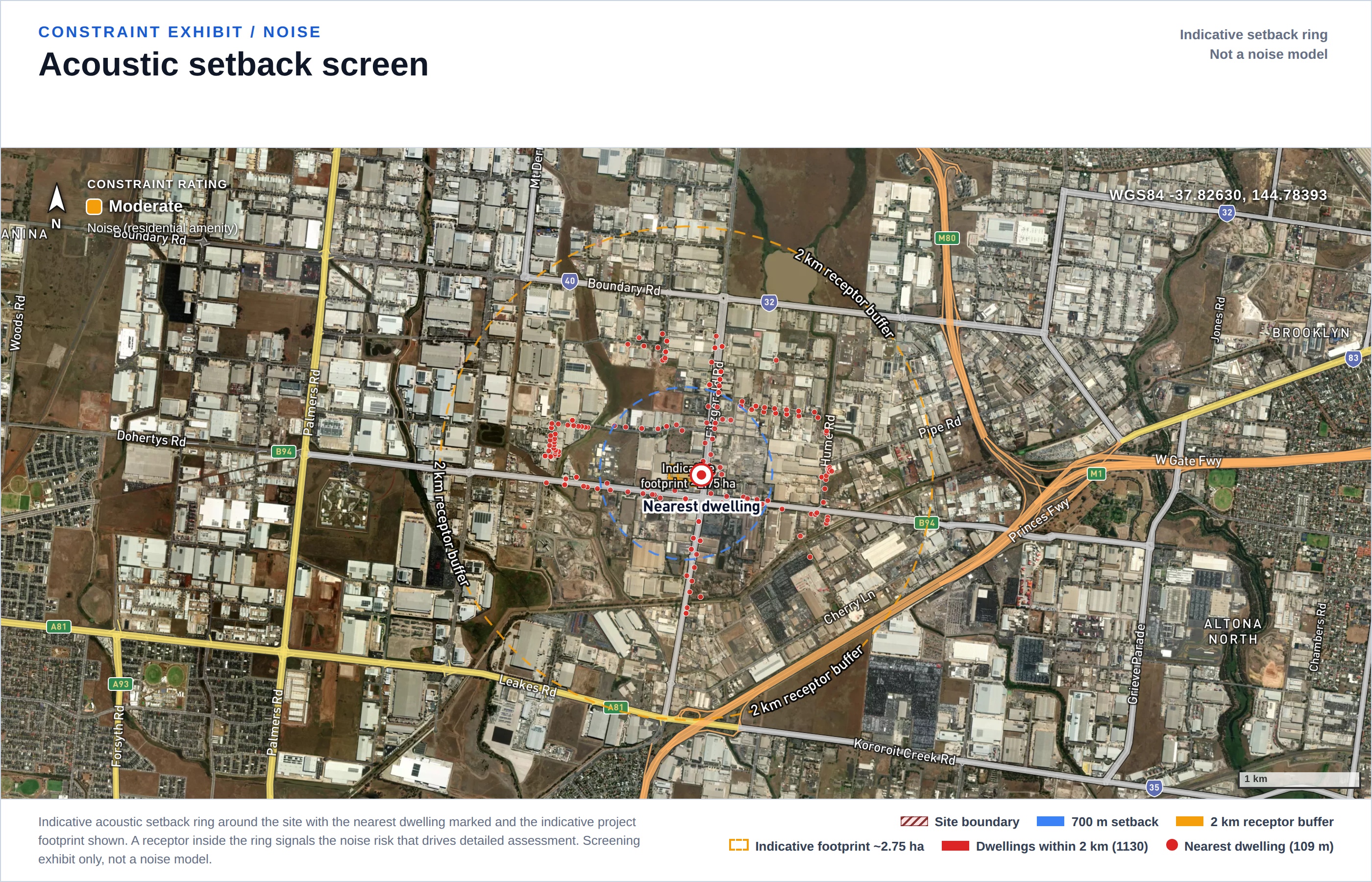
Noise receptor separation exhibit: dwellings around the site
Receptor separation exhibit
Full sample report Sample PDF

How It Works

Send a site. Get a memo back.

No software to adopt, no seats, no onboarding. It slots in front of your existing consultant workflow as an early filter.

01

Send one candidate site

An address, coordinates or a boundary file. That is all we need to start.

addresscoordinatesKML / GeoJSON
02

We run the desktop screen

19 constraints against state and federal spatial data: zoning, overlays, easements, bushfire, flooding, EPBC, heritage, soils and more. Ratings are weighted for a freight use: operational truck movements are intrinsic, so traffic is rated a primary assessment matter, and the on-site hazard question is framed around what you will store.

statutory referencesfreight-task weighting
03

Memo + PDF within one business day

An overall verdict, per-constraint ratings and data status, satellite exhibits, comparable approved logistics estates, and the recommended next checks for anything a desktop screen cannot close out.

verdictsite risk scorenext steps

Honest by Design

What this screen is, and what it is not.

19
constraints, two fields each
every constraint carries a rating AND a separate data status, so a gap in public data is disclosed as pending, never dressed up as clean

Two things we do not have, said plainly

Road network capacity. No traffic counts, intersection performance or pavement data is queried. The screen rates the freight task as a primary assessment matter because that is what it is for a logistics use, and it tells you a Traffic Impact Assessment with intersection modelling is where the real answer lives. It does not pretend to be that assessment.

Your goods profile. Whether dangerous-goods licensing applies depends on what you store, which no desktop screen can know. The report frames the question against state DG thresholds instead of guessing an answer.

What the screen does close out early, from public data:

  • Zoning and overlays: is the use even open to you here, and what schedules apply
  • Easements crossing the parcel: corridors that sterilise part of the buildable envelope
  • Ecology and EPBC: native grassland and threatened-community triggers that add seasons to a program (the sample site sits near the Angliss Grassland reserve)
  • Heritage, flood, bushfire, soils, contamination: per-constraint, each with its own data status
  • Receptor separation, honestly read: GNAF address points in industrial estates are often factory units, so the sample report caps the rating and names the address to confirm instead of crying wolf

Coverage varies by state and the report says so per constraint: Victorian screens run with full layer coverage; in NSW the Aboriginal heritage register is access restricted and council flood mapping is partial, so those constraints are reported pending there, not assumed clear. This is a preliminary desktop screen to support early site selection; it is not planning advice, and it does not replace the specialist assessments a development application requires.
Pricing

Priced like a filter, not a study.

A consultant desktop constraints study typically runs to five figures and takes weeks. This screen exists so you only commission those for sites that survive the first cut.

10-site credit pack

A$7,500 + GST
  • Screen a shortlist or an acquisition pipeline
  • Ranked side-by-side comparison across sites
  • Credits valid 12 months
  • Priority turnaround

Constraints that cannot be assessed from public data are disclosed as pending, never padded. If the screen returns materially less than the sample report shows for your state, we will say so before you pay.

Have a shortlist?

Send one real candidate site.

Address or coordinates. We reply with scope confirmation and an invoice, then the report within one business day.

Email a site Read the sample first