"Views" might be the most inflated word in Australian real estate. "District views" can mean a slice of rooftops between two gum trees. "Water glimpses" can mean standing on the toilet lid with your neck craned. "Elevated aspect" can mean the driveway has a slope.
The inflation exists for a rational reason: visual amenity is one of the most reliably priced attributes in property. Water view premiums in particular are among the best documented effects in property research. The size varies with the market, the type of water and how much of it you can actually see, but the direction is consistent enough that agents have every incentive to stretch the word. When a word moves prices, listing copy inflates.
Which leaves you with a verification problem: how do you tell a genuine outlook from an adjective, before you spend another Saturday driving to inspections?
The short version
| Your own eyes | Topographic maps | Satellite + street view | Modelled score | |
|---|---|---|---|---|
| Cost | Free | Free | Free | Free |
| What you get | The actual view | Terrain shape | Surrounding density | 0-100 amenity score |
| Covers | Addresses you visit | Anywhere, with practice | Anywhere, with some lag | Every address |
| Best for | The final call | Reading elevation | Spotting what blocks the view | Shortlisting + flagging over-claims |
The rest of this guide goes through each, plus a two-minute primer on what physically creates a view, so you know what you are looking for.
First: what actually creates a view, in two minutes
Strip away the adjectives and a view is made of four measurable things:
- Relative elevation, not altitude. An outlook comes from sitting higher than your surroundings, not from being high above sea level. A hilltop house in a flat suburb has a view; an address on a valley floor in the mountains does not, even though it might sit hundreds of metres higher on the map. What matters is the elevation advantage over the terrain and rooftops around you, and that is measurable from elevation data.
- Water, with the ocean strongest. Water is the outlook people pay most for, and the ocean and coastline are the heavyweight version of it. Rivers, lakes and reservoirs count too, just less. Water outlooks also tend to be durable: nobody is building a row of townhouses on the bay, so a water view is harder to lose than a view across someone else's backyard.
- Openness. The building density around an address decides how much sky and distance you get. A ridge line surrounded by six-storey apartments delivers less than the contours promise. Density can change, openness today is not openness forever, but current building density is at least a measurable starting point.
- Greenery. Parks, gardens and tree canopy nearby. A green outlook is not a harbour panorama, but it is real visual amenity, and it shows up in what people are willing to pay for a street.
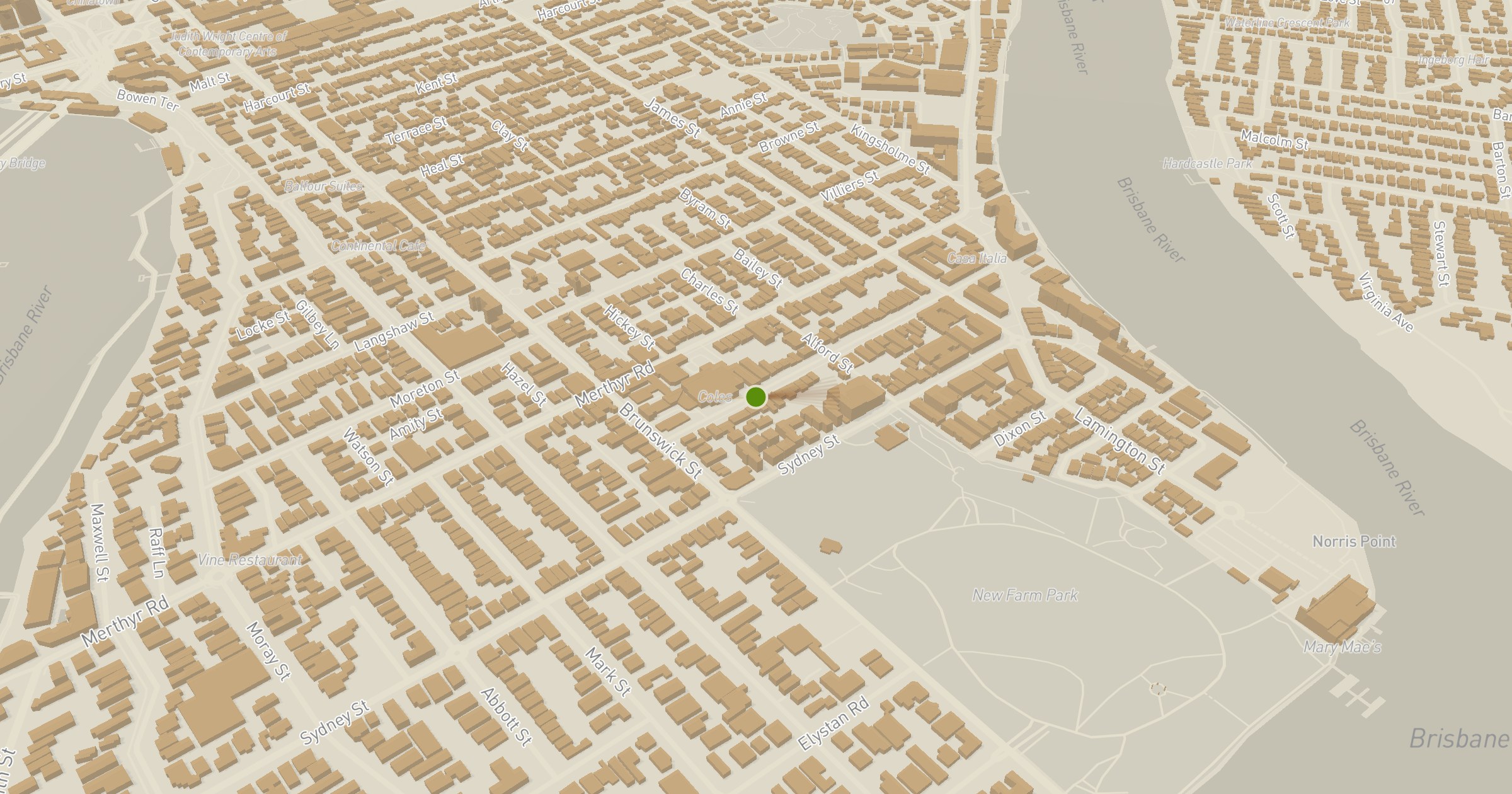
One more distinction worth carrying into every inspection: "water glimpses" from one bathroom window is a different asset to an elevated outlook. The glimpse is a fragile sightline through a gap that a neighbour's second-storey extension can close forever. The elevated outlook is a property of the location itself. Both get the same adjectives in listing copy, which is precisely the problem.

Option 1: Inspect with your own eyes (free, the final judge, always)
Nothing replaces standing in the living room and looking out the window. Whether a specific dwelling captures a view depends on which way the windows face, where the glazing is, and what floor you are on, and only your eyes can settle that.
Do it properly: check the view from the rooms you will actually live in, at the height you will actually stand, not from the best corner of the balcony the agent walks you to. And look at what sits between you and the view: a vacant block or a single-storey neighbour in the sightline is a future risk, not a feature.
The catch: by inspection time you have usually shortlisted three properties, not thirty. Your eyes are the final judge, but they are an expensive way to filter, and they cannot tell you whether the suburb two ridges over would have given you more outlook for the same money.
Option 2: Topographic maps and contour lines (free, readable with practice)
Contour lines are the original view-checking technology, and they are free. Lines packed close together mean steep ground; wide spacing means flat. The trick for views is the relative read, not the absolute numbers: does the address sit on a ridge, a slope facing the water, or a hollow? Is there higher ground between it and the thing the listing says it overlooks?
Our map includes contour layers for most states, so you can usually do this read directly on the same screen you are checking a property on. With a little practice you can debunk an "elevated position" claim in about thirty seconds.
The catch: contours describe terrain, not buildings. A perfect north-facing slope means little if a wall of apartments went up at the bottom of it. Terrain is necessary for a view; it is not sufficient.
Option 3: Satellite and street view (free, shows the blockers)
Satellite imagery answers the question contours cannot: what is actually built around the address. Scan the surrounding blocks for building density, tree cover and anything tall in the direction of the supposed view. Then drop into street view and stand at the kerb, looking the way the windows face.
The catch: imagery lags reality by months or years in fast-developing areas, and street view shows you the street, not the view from a second-storey window. You can rule a view out this way far more reliably than you can rule one in.
Option 4: A free modelled view score (instant, every address)
This is what we built at DA Leads: a free view quality score for any address in Australia, on our view quality score page. Type an address, get a 0-100 score with the factors behind it.
What the number is
The score measures the ingredients of a view, the same four things from the primer, split into five factors, each measured independently from data and weighted by how much it contributes to visual amenity:
| Factor | Weight |
|---|---|
| Ocean and coast proximity | 3.0 |
| Elevation advantage over surroundings | 2.5 |
| Green space proximity | 2.0 |
| Building openness | 2.0 |
| Inland water proximity | 1.5 |
Ocean proximity carries the heaviest weight: it is the outlook the market values most and the one that cannot be built out. Elevation advantage is measured relative to the surrounding terrain, so the hilltop in a flat suburb scores well and the valley floor in the mountains does not, exactly as your eyes would judge it.
One design decision worth spelling out: factors without data are excluded from the weighted average rather than penalised. If a dataset is silent about an address, the score is computed from the factors we can actually measure, instead of quietly dragging the number down and pretending we checked.
As a worked example, a score of 58 reads as "Good Views": an elevated address with water within a couple of kilometres. Not a clifftop panorama, but a location where the raw material of an outlook genuinely exists.
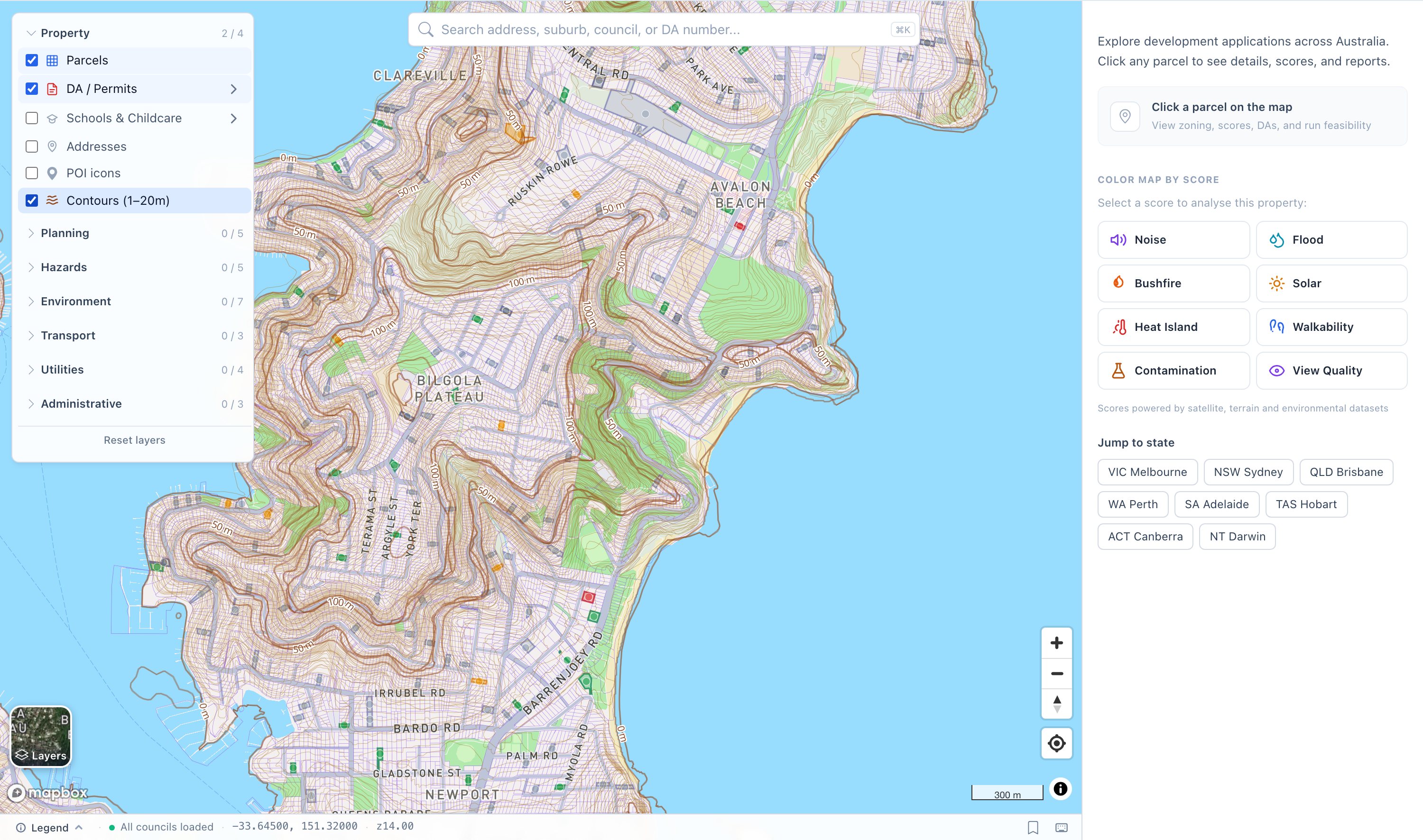
Contour lines on our map across Bilgola and Avalon: the ridges and plateau edges that create genuine outlooks, readable before you ever inspect.
What the number is not
Stated plainly: this is an amenity model, not a sightline simulator. It does not raytrace what is visible from a specific window. It does not know that the house next door has a double garage exactly where the bay would be. A high score means the location has the raw material of visual amenity: the water is close, the ground is high, the surroundings are open. Whether a specific dwelling captures that amenity depends on orientation, glazing and floor level, which no address-level model can honestly claim to know. Any tool that says it can tell you what you will see from the living room, without knowing which way the living room faces, is overreaching.
Which option should you use?
- Shortlisting suburbs or comparing twenty addresses: the modelled score, free and on the same scale everywhere. It is also the fastest way to flag an over-claimed listing: when the copy says "stunning water views" and the score says the address is low-lying, three kilometres from the water and hemmed in by apartments, someone is exaggerating, and it is not the elevation model.
- Checking a specific claim: contour lines on the map for the "elevated" part, satellite and street view for the "uninterrupted" part.
- The final call: your own eyes, at the inspection, from the actual rooms, looking at what stands between the windows and the view. Always.
FAQ
Do views add value to a property? Yes, and water views are among the best documented premiums in property research. How much depends on the market, the type of view, how much of it the dwelling captures and how durable it is; a protected elevated water outlook and a fragile side-window glimpse are priced very differently. There is no single percentage that honestly covers all of it.
How can I tell if a property has views before inspecting? Combine a free modelled view score (which measures water proximity, elevation advantage, greenery and openness for any address) with contour lines to verify the elevation claim and satellite plus street view to check what is built in the sightline. Then confirm with your own eyes at inspection, because no address-level tool can see out a specific window.
Why does elevation matter more than altitude? Because a view is relative. Sitting 400 metres above sea level on a plateau where everything else is also at 400 metres gives you no outlook at all, while sitting 30 metres above a flat coastal suburb can give you a horizon. What creates the view is the elevation advantage over your surroundings, which is why our score measures relative elevation rather than raw altitude.
What does the DA Leads view quality score measure? Five weighted factors: ocean and coast proximity (weight 3.0), elevation advantage over the surrounding terrain (2.5), green space proximity (2.0), building openness (2.0) and inland water proximity (1.5), combined into a 0-100 score. Factors without data are excluded from the average rather than penalised. It is free for any address in Australia.
Can the score tell me what I will see from the living room? No, and we would rather say so than pretend. The score is an amenity model: it measures whether the ingredients of a view exist at the location. Sightlines from a specific room depend on orientation, glazing and floor level, which is what the inspection is for.
Check any address free on the map, or read the full methodology and honest limitations on the view quality score page.