Land remembers what stood on it. Old fuel depots, dry cleaners and factories leave legacies in soil and groundwater that outlast the buildings, and usually outlast anyone's memory of the buildings. The service station on the corner gets demolished, the block gets a townhouse row, and the underground tanks can sit exactly where they were left.
The timing is the cruel part. Contamination usually surfaces deep into a purchase, at the environmental assessment, after the building inspection and the finance approval, at the point where walking away is expensive. For developers it can be worse: remediation can run to six or seven figures, which is the kind of line item that kills a project rather than trimming its margin.
So how do you actually check what was on a piece of land before you commit to it?
The short version
| State EPA registers | DIY site history | Phase 1 assessment | Phase 2 assessment | Free modelled score | |
|---|---|---|---|---|---|
| Cost | Free | Free | Professional fee | Professional fee + lab costs | Free |
| What you get | Confirmed, notified sites only | What stood on the land over decades | Records review + site walk, expert opinion | Actual soil and groundwater data | 0-100 screen: registers + industrial history |
| Covers | VIC, NSW and WA searchable; others patchy | Wherever imagery exists | Per site | Per site | Every address |
| Best for | First check where available | Curiosity + corroboration | Transactions on suspect land | Confirming or clearing a real concern | Shortlisting + comparison |
The rest of this guide goes through each, plus a two-minute primer on how land contamination works so the results actually mean something.
First: how land contamination works, in two minutes
A few basics make every register search and consultant report easier to judge:
- Contamination is a legacy in soil and groundwater, not a smell or a stain. Fuel and solvents soak in, heavy metals stay put, and groundwater can carry dissolved contaminants beyond the boundary of the site that caused them. Most of it is invisible from the surface, which is why a tidy lawn tells you nothing.
- A handful of land uses have most of the track record. Service stations and fuel depots (leaking underground tanks), dry cleaners (solvents), industrial works and factories (metals, chemicals, waste handling) and landfill are the classic offenders. If a suburb was once industrial, some of its land carries that history whether or not anyone wrote it down.
- Registers are the floor, not the ceiling. State registers list confirmed, notified sites: contamination that was found, reported and processed by the regulator. Plenty of historical industrial land never made the list, because nobody ever tested it. A register hit near an address means a lot. A register miss means much less than people assume.
- Professionals work up a ladder. A desktop site-history review pulls old records, titles and aerial photos to establish what the land was used for. A Phase 1 environmental site assessment adds a site walk and expert judgement about whether contamination is plausible. A Phase 2 assessment is the only rung that involves actually sampling soil and groundwater and sending it to a lab. Each rung exists to decide whether the next, more expensive one is warranted.

When it legally matters
Contamination is not just a private due-diligence question; the planning system cares too.
In NSW, the planning certificate issued for a property commonly carries contamination-related notations where the land is affected by certain regulatory actions or policies. What exactly appears, and when, depends on the council and the circumstances, so treat the certificate as a signal to read carefully rather than a complete answer. Your conveyancer should be looking at it anyway.
More broadly, development on formerly industrial land commonly triggers assessment requirements. Councils and consent authorities routinely ask for site contamination investigations before approving residential development on land with an industrial past, and rezoning or redeveloping such land without dealing with the question tends not to survive the approval process. If you are buying to develop, assume the contamination question will be asked eventually, and that it is far cheaper to ask it yourself first.
Option 1: State EPA registers (free, but state-by-state)
Every state and territory regulator keeps records of contaminated sites. How usable those records are varies enormously.
Victoria, NSW and Western Australia publish registers that can be searched or queried online: you can look up an address or area and see confirmed, notified sites nearby. If the state makes it searchable, it is the single best free check available, because a register record is the strongest signal there is that something real happened on that land.
The catch: the registers are state silos, each published differently, and the other states and territories publish far less accessibly, with records that can require written requests or sit in formats you cannot practically search. And even where the register is good, remember the primer: it lists the contamination that was found and notified. It is the floor, not the ceiling.
Option 2: Historical aerial imagery (free, the DIY site history)
The cheapest way to see what stood on a block is to look at old photos of it. Most state governments publish historical aerial photography through their spatial and land portals, in some areas going back to the mid twentieth century, and even Google Earth's history slider covers recent decades for most of urban Australia.
Scroll backwards through time over the address. Sheds, tanks, workshops, disturbed ground, a service station canopy on the corner, rows of glasshouses or market gardens: each of these is a lead worth pulling. This is a manual version of exactly what a professional desktop study does, and for the price of an evening it can tell you whether a "brand new estate" was a factory ten years ago.
The catch: it takes time per address, older imagery can be coarse or missing, and interpretation is a skill. Aerial photos tell you what stood on the land, not what leaked from it. Use this to raise questions, not to settle them.
Option 3: Phase 1 and Phase 2 assessments (the real tool where it matters)
When a transaction genuinely turns on the contamination question, the answer comes from an environmental consultant, and it comes in stages.
A Phase 1 environmental site assessment is a structured investigation of the site's history and condition: land-use records, register searches, historical imagery, interviews where possible, and a physical site walk. No sampling. The output is a professional opinion on whether contamination is plausible, and whether intrusive investigation is warranted.
A Phase 2 assessment is that intrusive investigation: soil bores, groundwater wells where needed, laboratory analysis, results assessed against the relevant criteria. This is the only option on this list that produces actual data about what is in the ground, and it is what regulators, financiers and consent authorities lean on when the stakes are real.
The catch: professional fees, and weeks rather than minutes. Nobody commissions a Phase 1 per shortlisted property, which is exactly why the free screening options above and below exist: they tell you which properties deserve one.
Option 4: A free contamination score (instant, every address)
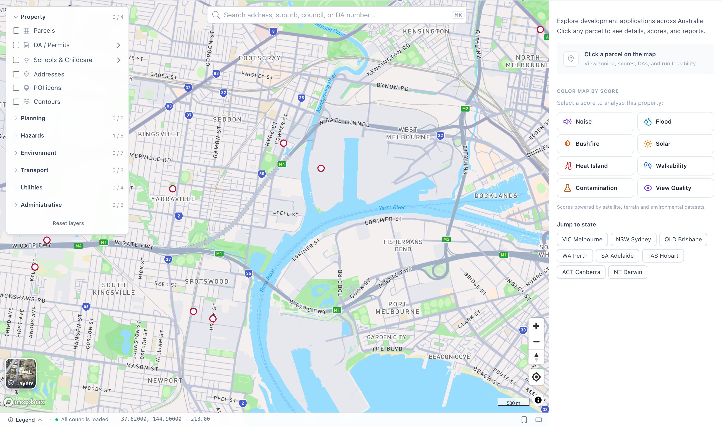
This is what we built at DA Leads: a free contamination risk score for any address in Australia. Type an address, get a 0-100 score with a plain-language label, and see what was actually found.
Be clear about what the number is. The score runs from 0 to 100 where 100 is cleanest. It combines two signal layers. First, we query the official contaminated-land registers of Victoria, NSW and Western Australia live; a register site near the address is the strongest signal there is, and it dominates the score. Second, everywhere in the country, we measure proximity to the land uses that generate most contamination legacies: fuel stations, factories and industrial facilities, dry cleaners and similar industrial points, drawn from a continental places dataset. Both layers are distance-weighted, because a register site at 100 metres and one at 900 metres are very different findings. A typical clean result looks like a 92, labelled Very Clean, with no register sites within the primary 500 metre screening radius.
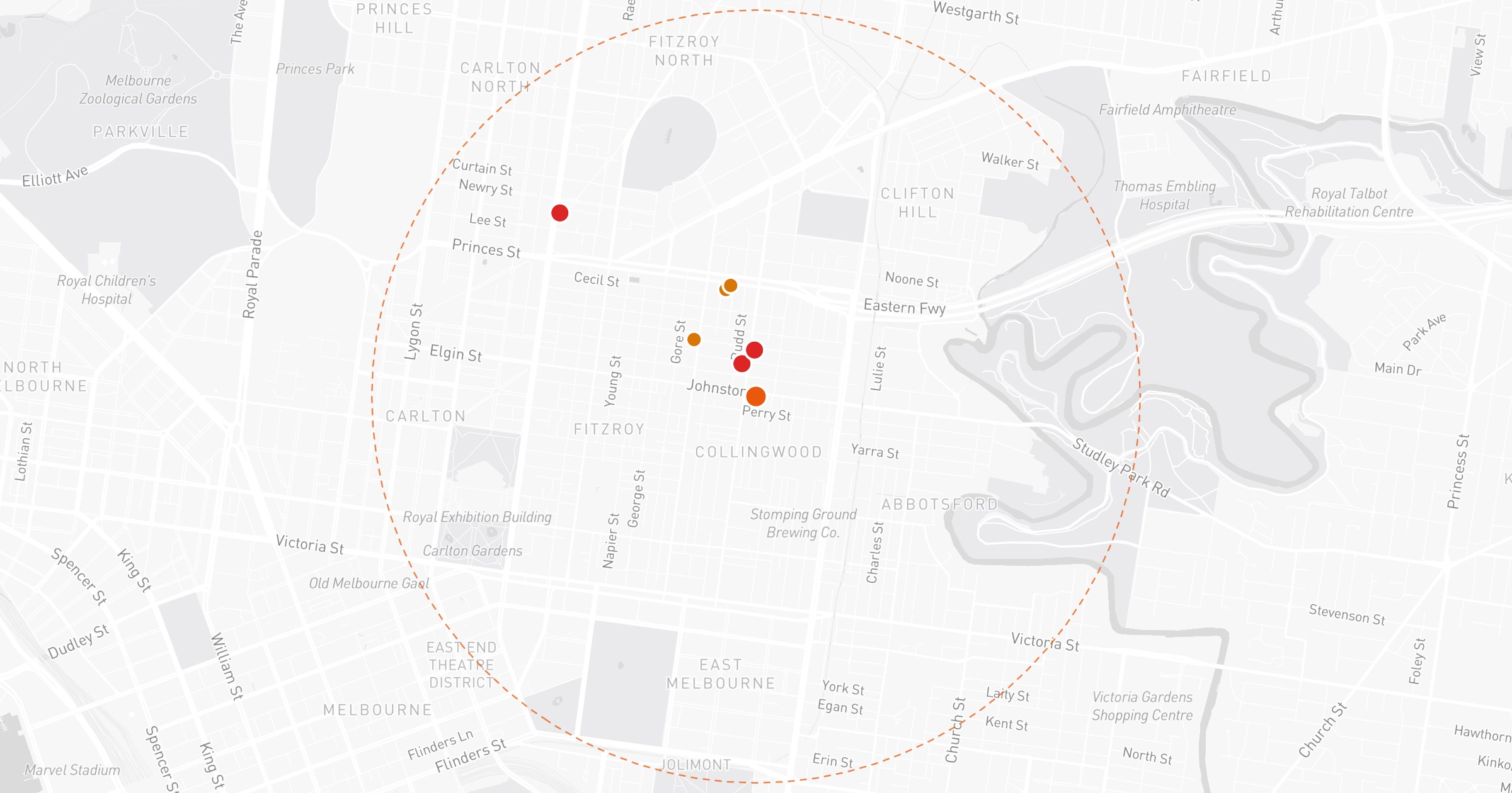
The contaminated sites layer on our map across Melbourne's inner west: red markers where the register has entries, thickest over the old industrial belt.
The honesty architecture
The difference between "the EPA has a record near this address" and "there is a fuel station nearby" matters enormously, so the score is built to never blur the two:
- A proxy is never dressed up as a register. Industrial proximity signals are labelled as proxies for historical risk, not as findings.
- Missing registers are flagged, not papered over. Queensland, South Australia, Tasmania, the ACT and the NT do not publish registers we can integrate, so scores there rely on industrial proximity alone and the response explicitly marks the official register as not integrated for that state, with a pointer to check the state's own records directly.
- "Checked, no hit" is stated in so many words. Where a register exists and returns nothing, the response says so, because absence of evidence only means something when you know what was actually checked. And if a register cannot be reached at query time, the response says that too, and notes the score may understate risk, rather than quietly pretending the check happened.
You can try it on the contamination score page, or check it alongside every other layer on the map. It is free either way.
Which option should you use?
- Shortlisting suburbs or comparing candidate blocks: the free score, plus a direct register search if you are in VIC, NSW or WA. Instant, same scale everywhere.
- A specific address you are getting serious about: an evening with the historical aerial imagery, guided by what the score flagged, plus a careful read of the planning certificate with your conveyancer.
- A transaction on land with an industrial past, or any development play: a Phase 1 assessment, escalating to Phase 2 if the consultant says so. Bring the screening picture as a starting map, not a substitute.
FAQ
How do I find out if my land is contaminated? Layer the checks. Start with a free screen (our contamination score covers every Australian address), search the state register directly if you are in VIC, NSW or WA, scroll through historical aerial imagery to see what stood on the land, and read the planning certificate. If any of that raises a real flag, or the land has an industrial past, commission a Phase 1 environmental site assessment.
What is a Phase 1 environmental site assessment? A professional investigation of a site's history and condition: records, register searches, historical imagery and a site walk, but no sampling. Its job is to conclude whether contamination is plausible and whether a Phase 2 investigation, with actual soil and groundwater sampling, is warranted.
Does a clean register search mean the land is clean? No. Registers list confirmed, notified contamination: sites that were tested, reported and processed. Plenty of historical industrial land was never tested, so it never made any list. A clean register search means no known problem, which is useful, but it is the floor of your due diligence, not the ceiling.
Which states publish contaminated-land registers you can actually search? Victoria, NSW and Western Australia publish registers that can be queried online, and our score queries all three live. The other states and territories keep records but publish them less accessibly, so for those you check with the state regulator directly, and our score is explicit that it is relying on industrial-proximity signals there.
Which land uses are most likely to leave contamination behind? Service stations and fuel depots, dry cleaners, factories and industrial works, and landfill have the worst track records, mostly through fuel, solvents, metals and waste reaching soil and groundwater. Former market gardens and glasshouse areas are also worth noting in a site history.
How much does it cost to fix contaminated land? It depends entirely on what is found and how far it has spread, which is why nobody sensible quotes a number before Phase 2 data exists. Remediation can be modest, and it can run to six or seven figures. That asymmetry is the whole argument for cheap early screening: the free checks exist so the expensive surprise happens to someone else.
Check any address free on the map, or read the full method, the register coverage and the honest limitations on the contamination score page.