
Parcel 2 in our data centre screening story was a 10.5 ha lot on Forsyth Road at The Crossing, Truganina, in Melbourne's western growth corridor. It failed. The engine counted 8,641 dwellings within 2 km, the nearest about 125 m from the boundary, and called the site what it is: a housing estate in mid-delivery, no place for an industrial plant whose cooling load runs through summer nights. Risk score 61 out of 100.
We ran the identical polygon through the identical engine again, this time as englobo residential. Verdict: "No fatal flaws identified". Zero major constraints, two moderates, risk score 36 out of 100, band "Workable with conditions".
Same paddock, same data layers, opposite answers, and neither run is wrong. A constraint is not a property of land; it is a property of a land-use pairing, and the 8,641 dwellings that sank the data centre are, for a residential subdivider, the entire commercial case. This article walks through how to read englobo land properly, using the Truganina screen as the worked example.
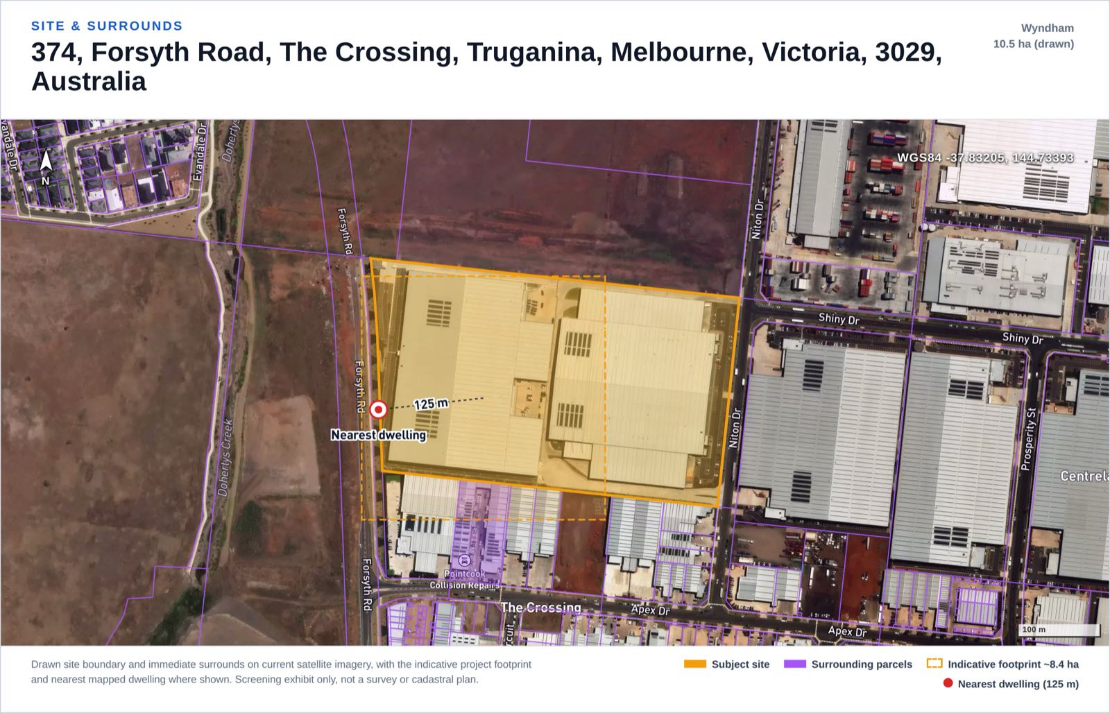 Site and surrounds exhibit from the englobo screening report our engine generated on the Truganina parcel. A real parcel used as a screening demonstration, not a client project and not a proposal for that land.
The direction flip: a subdivision builds its own receptors
Screen a battery, a data centre or a warehouse and the assessment reads outward: your plant is the source and every dwelling nearby is a liability. Screen the same dirt as englobo residential and the arrows reverse: the receptors are not something you find on the map, they are something you are proposing to build.
Our engine carries that reversal explicitly, and its wording is worth quoting because the flip is systematic, not cosmetic. On noise: "Sensitive-use development; external noise sources affecting the future dwellings must be identified (no noise-source layer is queried on a desktop)." The estate inherits its noise environment from the roads, rail lines and industry around it, so the screen's honest job is to pose the question, flag it data-limited, and hand it to an acoustic consultant at design, rather than pretend a spatial query settled it. The 8,641 surrounding dwellings appear in the report as urban interface context, not as receptors to be protected from you.
Hazard flips the same way: "A residential development carries no industrial on-site fire / explosion hazard. The hazard question runs the other way: separation FROM surrounding hazardous facilities, pipelines and major infrastructure must be confirmed." Bushfire is the cleanest illustration of receptor logic: the future dwellings are the receptors, so where a mapped bushfire hazard touches englobo land it shapes the subdivision layout itself. This parcel sits outside any mapped bushfire prone area, so the constraint rates insignificant here, but the direction of the question is the point.
And traffic scales with what you build: the engine asks for "a Traffic Impact Assessment scaled to the lot yield", with intersection and external road upgrades set through the development application and the contributions framework. Until you know the yield, traffic is a scoped question, which is how the screen rates it: minor, data-limited.
What actually decides englobo land
Five things carried the weight in this screen, and they are the five that decide most growth-corridor land.
The growth zone is the enabling machinery
The parcel is zoned UGZ2, Urban Growth Zone Schedule 2. In Victoria the Urban Growth Zone applies to land identified for future urban development: it manages the transition of non-urban land into urban land, with new communities developing generally in accordance with a precinct structure plan and fewer separate approvals once a PSP is approved. A precinct structure plan is the long-term plan for that urban development: it describes how the land is expected to develop and how and where services and infrastructure will support the new community. The schedule number is not decoration: each UGZ schedule wires a specific precinct's plan into the zone, so confirming what Schedule 2 requires of this parcel is the first conversation with the planning authority.
The overlay finding backs it up: the parcel carries a Development Contributions Plan Overlay (Schedule 9), so the levy machinery is already attached to the land. That cuts both ways: evidence the precinct planning is real, and a per-lot cost line you will pay when the lots register.
Volcanic-plain grassland, and the Commonwealth
Both of the screen's moderate ratings are ecological. The parcel intersects mapped threatened biota for the "Southern Plains including the Western Victorian volcanic plain and karst springs", and the Truganina South Nature Conservation Reserve sits about 1.6 km away: this is volcanic-plain grassland country, the ecological signature of Melbourne's west. That single mapped fact cascades into the second moderate, EPBC / Matters of National Environmental Significance: likely triggered, referral required.
What follows is concrete: a flora and fauna survey by a qualified ecologist, a native vegetation clearance assessment with offsets if clearing is required, a Protected Matters Search Tool report, and an EPBC self-assessment with referral to DCCEEW if a significant impact is likely. For englobo, ecology is a yield question as much as an approvals question: retained grassland and offset obligations come out of net developable area, the number your whole feasibility rests on.
Cultural heritage: a mapped trigger you can check on day one
Victoria makes part of the heritage question mappable. Under the Aboriginal Heritage Regulations 2018, a Cultural Heritage Management Plan is required when a high impact activity is proposed within a mapped area of cultural heritage sensitivity, and both terms are defined in the regulations. A CHMP is a substantial pre-permit workstream, so knowing on day one whether the mapped trigger applies is worth real money.
This parcel sits outside a mapped Area of Cultural Heritage Sensitivity, so there is no automatic CHMP trigger. The screen is careful with that finding: the sensitivity mapping is a model, not a complete site register, and protection under the Aboriginal Heritage Act 2006 (Vic) applies regardless, so an unexpected-finds procedure belongs in the civil works contract either way.
Easements: the quietest yield-killer
Nothing dramatic here, which is itself the lesson. No mapped easement or infrastructure corridor crosses the site, and the nearest transmission line (66 kV) is about 530 m away. The screen still rates cadastral and title as data-limited, because ownership, covenants and easements are not desktop-verifiable: the registered title is the controlling source, and ordering a Certificate of Title and plan of subdivision takes about a week.
For englobo buyers this deserves more paranoia than it usually gets. An easement through a subdivision does not subtract its own footprint from yield; it reorganises every lot and road around it, and on a 10.5 ha estate plan there is nowhere to hide that disruption. The title search is the cheapest document in the due diligence stack, and it is the one that finds this.
The urban interface: the market arriving
The receptor count that failed the data centre is the demand curve here: 8,641 dwellings within 2 km means comparable sales, trunk infrastructure under delivery, and a retail land market on the doorstep. The nearest existing dwelling, about 125 m away, is an interface and staging consideration (construction dust, noise, how the first stages address the homes already there), not a reason to walk.
The full screen, all 19 rows
Here is the complete constraint table from the demo report, generated 12 July 2026. Verdict: "No fatal flaws identified". 0 major, 2 moderate, 10 minor, 7 insignificant, 0 pending; 19 of 19 constraints assessed, data completeness 100%; risk score 36/100, band "Workable with conditions".
| # | Constraint | Rating | Data status | What the screen found |
|---|---|---|---|---|
| 1 | Zoning | Minor | Hit | UGZ2 (Urban Growth Zone, Schedule 2); assessment pathway to confirm |
| 2 | Cadastral / Title & Easements | Minor | Data limited | No mapped corridor crosses the site; title search required |
| 3 | Planning Overlays | Minor | Hit | Development Contributions Plan Overlay, Schedule 9 |
| 4 | Aboriginal Heritage | Minor | Hit | Outside a mapped sensitivity area; no automatic CHMP trigger |
| 5 | Historic / Federal Heritage | Insignificant | Assessed clean | No listed heritage place within 1 km |
| 6 | Bushfire | Insignificant | Assessed clean | Not within a mapped bushfire prone area |
| 7 | Flora & Fauna / Ecology | Moderate | Hit | Volcanic-plain threatened biota intersects; reserve about 1.6 km |
| 8 | EPBC / MNES | Moderate | Hit | MNES likely triggered; EPBC referral required |
| 9 | Hydrology / Flooding | Insignificant | Assessed clean | No mapped flood hazard; flat grade makes drainage a design item |
| 10 | Noise (residential amenity) | Minor | Data limited | Sensitive use; external sources to identify; nearest dwelling about 125 m |
| 11 | Visual Amenity | Minor | Hit | Terrain visibility moderate; site at 32 m in mixed terrain |
| 12 | Contours / Topography | Insignificant | Assessed clean | Mean slope about 1.4% |
| 13 | Geotechnical | Minor | Data limited | Not desktop-assessable; intrusive investigation required |
| 14 | Soils | Minor | Hit | Sodosols indicated (reactive / dispersive) |
| 15 | Utilities | Insignificant | Hit | 66 kV line 530 m; water / sewer main 301 m; gas pipeline 2,533 m |
| 16 | Traffic & Access | Minor | Data limited | Traffic Impact Assessment scaled to lot yield; upgrades set through the DA |
| 17 | Contaminated Land | Insignificant | Assessed clean | No EPA-listed site within 500 m |
| 18 | Air Quality | Minor | Hit | Construction dust only; no operational emissions |
| 19 | Hazard & Risk (fire / explosion) | Insignificant | Assessed clean | No industrial on-site hazard; confirm separation from surrounding facilities |
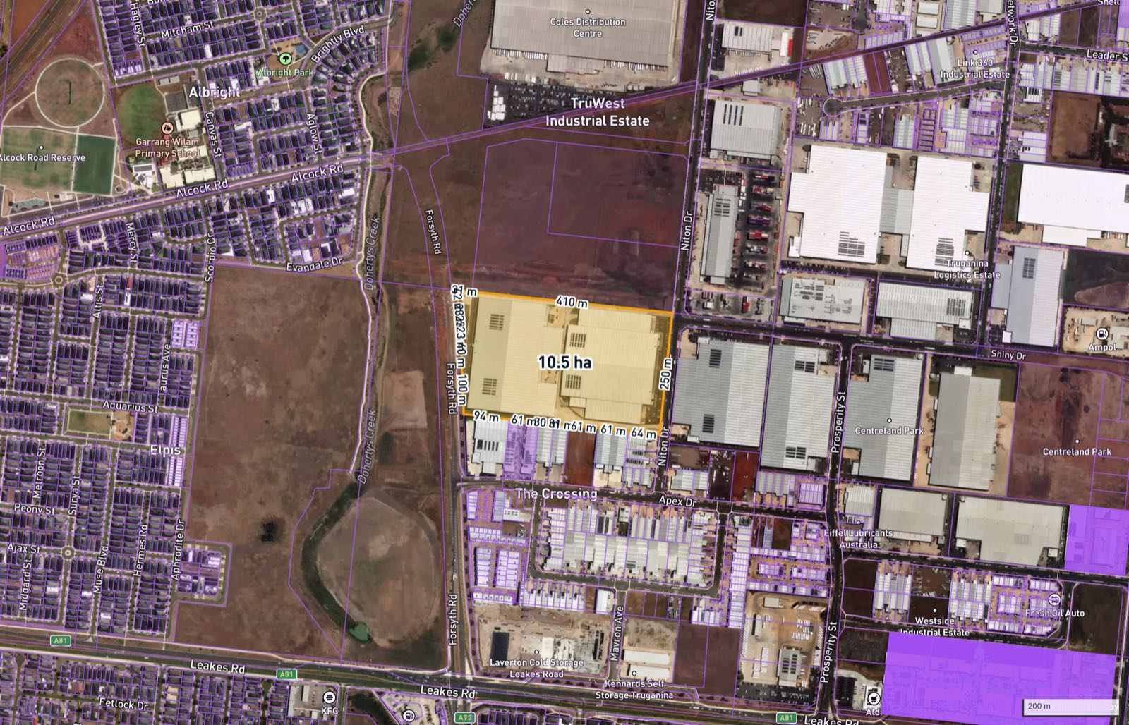 Constraint context exhibit from the same demonstration report. The full interactive version is the sample englobo report.
What this screen does not do
The report also keeps its data limits on the surface. Four constraints on this site are rated data-limited (title, noise, geotechnical, traffic), the EPBC rating comes from referral proximity and mapped matters rather than a Protected Matters Search, and vector data is generalised at zoom, so distances are indicative. A desktop screen that hides those caveats is telling you what you want to hear.
The instruments englobo strategies ride on
Englobo value is realised through enabling instruments; two recent ones show the machinery at both ends of the scale.
Shepparton South East, in regional Victoria, had its precinct structure plan and development contributions plan approved by the Minister for Planning and gazetted on 26 June 2025 under Amendment C117gshe, enabling about 2,980 dwellings. Before gazettal, land in a precinct like that is potential; after it, there is an applied plan and a funded infrastructure program to develop against. That is what a UGZ schedule ultimately delivers.
Appin (Part) Precinct in NSW's Greater Macarthur shows the other lesson: rezoning is not release. 1,378 ha was rezoned on 15 December 2023 for up to 12,900 homes, with about 470 ha protected for conservation, and a dwelling cap of 2,499 homes currently applies based on available infrastructure capacity. The enabling instrument controls timing as well as permission, and for an englobo hold, timing is most of the return.
Where this fits in your process
The order matters. Zone first: it is free and takes seconds on our map, which shows zoning, overlays and parcel boundaries for any address in Australia. Then screen the survivors before feasibility spend. Our englobo site screening runs the same 19-constraint desktop screen shown above, A$1,000 per site as a pilot, one business day, every rating carrying its data status. The Truganina report is the full sample: read it before you commission anything.
FAQ
What is englobo land? Englobo land is a large parcel, typically held in one title or a small number of titles, bought for its potential to be subdivided into many lots rather than for its current use. Its value rests on planning status, developable area and the cost of getting lots to market, which is why due diligence leans so heavily on the constraint layer.
What does a UGZ2 zoning mean for a buyer? The Urban Growth Zone applies to land identified for future urban development in Victoria and manages its transition to urban land, with development proceeding generally in accordance with an approved precinct structure plan. The schedule applies precinct-specific provisions, so confirming what the schedule requires of your parcel is the first check with the planning authority.
Why did the same parcel fail a data centre screen and pass as englobo? Because the use defines the constraint set. For a 24/7 industrial plant, 8,641 dwellings within 2 km are receptors to protect, and the parcel scored 61/100 and failed; for a residential subdivision the same dwellings are the arriving market, the future homes become the receptors, and the parcel scored 36/100, workable with conditions.
Do I need a Cultural Heritage Management Plan for englobo land in Victoria? A CHMP is mandatory when a listed high impact activity is proposed within a mapped area of cultural heritage sensitivity, and the permit cannot issue until the plan is approved. The demo parcel sits outside a mapped sensitivity area, so no automatic trigger applies there, but the mapping is a model rather than a site register and heritage protection applies regardless.
How does the EPBC Act affect an englobo subdivision? If a subdivision may significantly impact a Matter of National Environmental Significance, such as a listed threatened ecological community, it must be referred to the Commonwealth (DCCEEW) under the EPBC Act. On Melbourne's western volcanic plain that question comes up early: the demo parcel rated ecology and EPBC as its only two moderate constraints, with surveys and a Protected Matters Search as the next steps.
What does the englobo site screen cost and what does it cover? A$1,000 per site as a pilot, delivered in one business day. It is a desktop screen of 19 planning and environmental constraints with a verdict, a risk score and the data status of every rating, like the sample report; it is not planning advice and does not replace your consultants.


